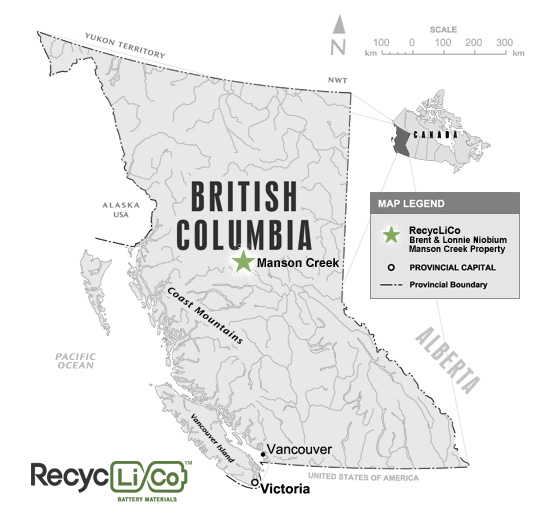
Property Overview
The Lonnie-Virgil Property is a niobium exploration property, this property consists of eight (8) mineral claims, currently totaling 2,735 hectares and is located on Granite Creek, south east of Manson Creek in North Central British Columbia, approximately three hours drive north of Fort St. James. The Company acquired the Lonnie Brent property on September 2007.
Altitude on the Property varies between 3,200 feet and 4,000 feet. While historically known for its showings of niobium, the Lonnie-Virgil Property has more recently become of interest for its rare-earth elements showings.
Historical trenching on the Brent Claims returned a strike length of 119 meters (390 feet) containing an average of 0.19% Nb205 and 0.18% of Zr (zirconium) higher grades were 0.57% Nb205. The zone is open on both ends and is up to 40 meters in width in the vicinity of the heliport. A 56 meter chip sample assayed 0.15% Titanium, 0.05% Lanthanum and 0.03% neodymium.
The Lonnie niobium showings contains significant niobium, grading 0.20% Nb205 over 500 metres (1640 feet) situated approximately four kilometers southwest on strike of the Brent Showing. Work done thus far has been limited. A total of 8 rock chip and 106 soil samples where taken from two areas surrounding known mineralization. The first was a 0.2 km X 0.15 km area centered on the Virgil trenches and the second was 1.4 km X 0.5 km area encompassing the Lonnie mineral occurrence. Of the 8 rock chip samples, 7 consisted of angular shaped, sub-crop boulders and cobbles float.